Property Record
3390 Old Alabama Rd, Alpharetta, GA 30022

NEARBY LISTINGS FOR SALE OR LEASE
Property Detail
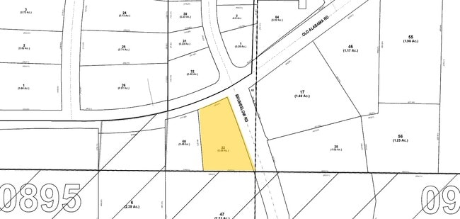
3390 Old Alabama Rd
12-3170-0896-022-4
Suntrust Bank Et Al
Financialbuilding
Fulton
X
Georgia
13121C0069F
896
2024
1.20 AC
2025
Roswell/Alpharetta
011443
Atlanta
2,594 SF
Atlanta-Sandy Springs-Roswell, GA
DEMOGRAPHICS near 3390 Old Alabama Rd
1 Mile
3 Mile
5 Mile
2024 Total Population
8,960
67,223
191,415
2029 Population
9,047
68,404
195,202
Pop Growth 2024-2029
+ 0.97%
+ 1.76%
+ 1.98%
Average Age
41
40
40
2024 Total Households
3,076
24,934
73,316
HH Growth 2024-2029
+ 1.01%
+ 1.88%
+ 2.12%
Median Household Inc
$144,411
$130,167
$117,737
Avg Household Size
2.90
2.60
2.60
2024 Avg HH Vehicles
2.00
2.00
2.00
Median Home Value
$496,041
$517,709
$476,081
Median Year Built
1989
1990
1990
Nearby Places
Map Layers
Map Styles
 Street
 Aerial
- Restaurants
- Banks
- Shops
- Fitness
- Groceries
PUBLIC TRANSPORTATION
AIRPORT
Hartsfield - Jackson Atlanta International
DRIVE
WALK
Distance
Hartsfield - Jackson Atlanta International
49 min
33.8 mi
Nearby Properties
Address
Land Use
TOTAL SIZE
Lot Size
Zoning
Address
Land Use
TOTAL SIZE
Lot Size
Zoning
9,544,248 SF
74.91 AC
R4
Address
Land Use
TOTAL SIZE
Lot Size
Zoning
4,705,880 SF
8.55 AC
OI
Address
Land Use
TOTAL SIZE
Lot Size
Zoning
415,701 SF
6.75 AC
OI
Address
Land Use
TOTAL SIZE
Lot Size
Zoning
434,804 SF
4.96 AC
Address
Land Use
TOTAL SIZE
Lot Size
Zoning
241,349 SF
35 AC
OI
Address
Land Use
TOTAL SIZE
Lot Size
Zoning
1,159,560 SF
7.12 AC
CUP
Address
Land Use
TOTAL SIZE
Lot Size
Zoning
1,196,908 SF
30.28 AC
OI
Address
Land Use
TOTAL SIZE
Lot Size
Zoning
1,423,656 SF
15.44 AC
OI
Address
Land Use
TOTAL SIZE
Lot Size
Zoning
2,109,527 SF
70.17 AC
OP
Address
Land Use
TOTAL SIZE
Lot Size
Zoning
666,599 SF
24.20 AC
PSC
Address
Land Use
TOTAL SIZE
Lot Size
Zoning
4,821,900 SF
20.58 AC
R4C
Address
Land Use
TOTAL SIZE
Lot Size
Zoning
761,850 SF
4.77 AC
OI
Address
Land Use
TOTAL SIZE
Lot Size
Zoning
367,876 SF
41.40 AC
PSC
Address
Land Use
TOTAL SIZE
Lot Size
Zoning
2,480,205 SF
37.86 AC
C1
Address
Land Use
TOTAL SIZE
Lot Size
Zoning
6,769,095 SF
21.82 AC
OI
Address
Land Use
TOTAL SIZE
Lot Size
Zoning
1,351,350 SF
19.20 AC
OICON
Address
Land Use
TOTAL SIZE
Lot Size
Zoning
211,069 SF
14.91 AC
OI
Address
Land Use
TOTAL SIZE
Lot Size
Zoning
1,592,455 SF
21.50 AC
R3
Address
Land Use
TOTAL SIZE
Lot Size
Zoning
1,747,896 SF
36.51 AC
C1C
Address
Land Use
TOTAL SIZE
Lot Size
Zoning
257,871 SF
46.98 AC
OI
Address
Land Use
TOTAL SIZE
Lot Size
Zoning
842,228 SF
17.66 AC
OI
Address
Land Use
TOTAL SIZE
Lot Size
Zoning
2,849,264 SF
21 AC
OI
Address
Land Use
TOTAL SIZE
Lot Size
Zoning
247,067 SF
4.97 AC
OI
Address
Land Use
TOTAL SIZE
Lot Size
Zoning
1,438,388 SF
27.46 AC
OI
Address
Land Use
TOTAL SIZE
Lot Size
Zoning
2,066,346 SF
22.96 AC
R4C
Address
Land Use
TOTAL SIZE
Lot Size
Zoning
879,828 SF
28 AC
PSC
Address
Land Use
TOTAL SIZE
Lot Size
Zoning
1,994,949 SF
14.41 AC
R4C
Address
Land Use
TOTAL SIZE
Lot Size
Zoning
12.96 AC
OI
Address
Land Use
TOTAL SIZE
Lot Size
Zoning
174,304 SF
24.84 AC
OI
Address
Land Use
TOTAL SIZE
Lot Size
Zoning
126,630 SF
30 AC
R1
The World's #1 Commercial Real Estate Marketplace
Connect with us
© 2025 CoStar Group
The information above has been obtained from sources believed reliable. While we do not doubt its accuracy we have not verified it and make no guarantee, warranty or representation about it. It is your responsibility to independently confirm its accuracy and completeness. Any projections, opinions, assumptions, or estimates used are for example only and do not represent the current or future performance of the property. The value of this transaction to you depends on tax and other factors which should be evaluated by your tax, financial, and legal advisors. You and your advisors should conduct a careful, independent investigation of the property to determine to your satisfaction the suitability of the property for your needs.